Myrtle Beach Map
Myrtle Beach map of local roads, streets & highways with locations of attractions, shopping, and beaches
Myrtle Beach Maps - Myrtle Beach Street Atlas

The Myrtle Beach map by Rand McNally
The map includes airports, hospitals, police stations, schools, government buildings, shopping centers, parks, golf courses, post offices, and more. Travel routes in the area include major highway symbols and line differentiation for controlled and uncontrolled access, undivided highways, streets, and minor roads. Don't get lost while you're on vacation ! Get the Myrtle Beach map and drive straight to your favorite hotel, attraction, golf course and restaurants.
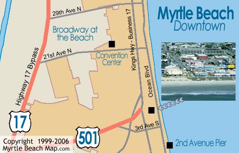
Map of Myrtle Beach Downtown
 To the left is a map of the Myrtle Beach downtown area, which is home to Ripley's Believe It or Not, the former Myrtle Beach Pavilion, Peaches Corner, Oceanfront Bar and Grill, the Gay Dolphin Gift Shop, Family Kington Amusement Park, and more.
For streets and attractions of the entire Grand Strand, see the Myrtle Beach interactive map.
You can zoom in and out and move and search all areas.
The interactive map requires flash player.

Internet Marketing by Myrtle Beach Inc. ©1999-2024.